We parked at the Phelps Creek trailhead only to find at least 60 cars ahead of us. What a zoo! Fortunately, after walking 3-4 miles along the flat riverbed, we hung a right at the Leroy Creek basin climbers trail, and climbed up into the high basin to camp. There were a few tents there, but probably nowhere close to the mob scene at Spider Meadows, which would have been our approach if we stuck with climbing Chiwawa. The first 1000 ft up are pretty steep, but the grade leveled off into Leroy Basin. We were reasonably fast going to base camp (3 hours).
This was Lisa's first outing since her heel healed, so she and Jim hung out in base camp while Julie and I scouted the approach that we would follow in the dark the next morning. The climbers trail was a pretty good boot path until the talus fields, then we started following cairns. A woman at the trailhead had warned us about a deep gulley that was a pain to get into and out of, and that gulley became quite obvious as we got close to it. Supposedly it's been there for a few years, but it still looks fresh. We found the best booth slide down and up the other side, but it would not be fun to do in the dark.
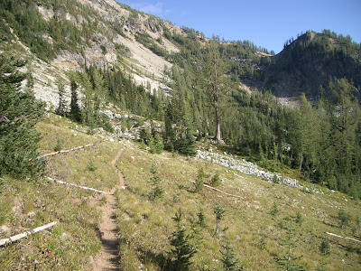
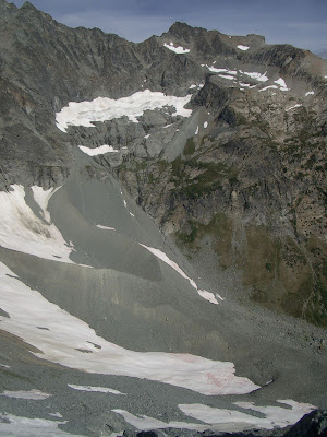
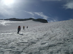
Climbers trail from Leroy Creek basin toward 6800 ft col just before talus fields. South ridge of Mt. Maude above.
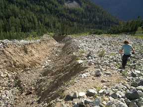
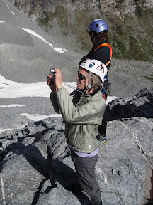
Julie on recon at the 30-ft deep gulley
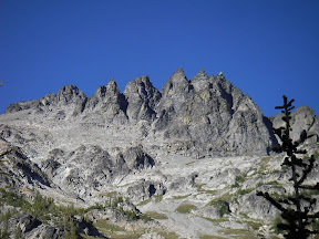
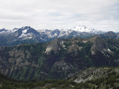
Seven-Fingered Jack from Leroy Creek Basin
Expecting a 14-hour day, we got up at 4:00 and left at 5:00 a.m., following our newly rebuilt cairns across the talus to the gulley. Yes, it was a pain. The talus continued up to the south end of Leroy basin at 6800 ft, then we continued up the shoulder to the col with the Ice Lakes basin. By this time it was light, and we could see the clouds already starting to build. Having been skunked by the weather all summer and having cowered from thunder and hailstorms in the Tetons and City of Rocks recently, I wasn't pleased. Plus, I was feeling not quite up to par thanks to some stomach bug.
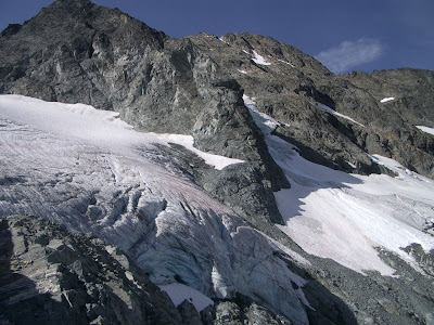
Fortunately, the 7600-ft traverse across the bench was easy to spot from the col. Unfortunately, there was very little snow left on it. Sidehilling a somewhat-steep slope covered with talus takes a lot of time and concentration. Snow is much better. But we continued to traverse above upper Ice Lake toward Marmot Pyramid. It took us longer than expected, though, thanks to the loose conditions. We reached the top of the South Entiat Glacier by about 10:00 (5 hours).
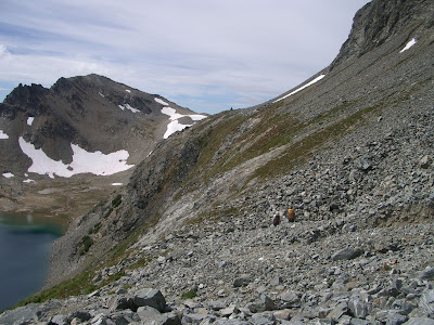
Traverse above Upper Ice Lake on 7600-ft bench under late-summer (no snow) conditions
Looking at the headwaters of the Entiat River, then looking at the topographic map, it's clear that things have changed. Drastically. There are several glaciers shown in the cirque below Maude, Seven-Fingered Jack, and Fernow that simply don't exist or are very small remnants of their former selves. I guess one advantage to doing this trip so late in the season is that it's easy to distinguish snowfields from glacier. And now it's mostly snowfields that melt out each year.
Upper Entiat basin, below Maude and Fernow. Topo maps show several glaciers here, but they are long gone.
Mindy and Julie survey the scene.
We decided to rope up and head down the South Entiat Glacier 800 ft to the base of the Entiat Icefall, as in the trip description. But we stopped at some rocks showing near the current base of the South Entiat Glacier, looking at the snout of the glacier. No wonder the original description calls for nine pitches-- it used to start way down there! At least three pitches have melted out completely. Instead of walking down the South Entiat to the base of the climb, you now have to hug the south wall of the Marmot Pyramid and look for a boulder to rappel off of to the start of the climb.
Snout of South Entiat Glacier, with Marmot Pyramid and the base of the Entiat Icefall in late-summer conditions (September 2, 2007). To reach the icefall, rap from the base of Marmot Pyramid.
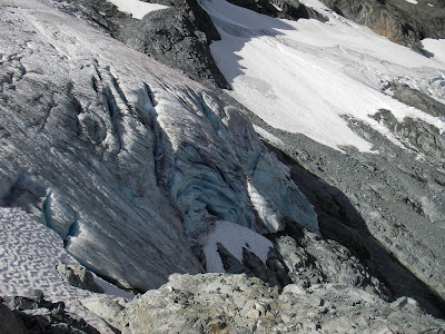
Close-up of snout of South Entiat Glacier and base of Entiat Icefall. Fresh icefall debris barely visible near upper right side of photo.
We never got a clear view of the entire icefall, but the base of it is no longer snow covered ice-- it's ice. Plus, there was new icefall debris at the base of the icefall (huh, maybe that's why they call it an ice-fall!). We had plenty of time, but with a series of yellow lights, we decided to turn around. I wasn't feeling great, Lisa wasn't sure she was up for a full 14-hour climb, the clouds were threatening, conditions had deteriorated on the icefall, and I wasn't convinced our party could move fast enough in case the weather got worse. Darn. The curse of Summer 2007.
Heading back up the South Entiat Glacier after turning around. Weather looked momentarily clear!
Maude is a very worthy objective, and I'd like to return to climb the icefall, but aiming for mid-August. Even though it was climbed over Labor Day weekend in 2000, the conditions this late in the season in 2007 just won't work (except maybe in high snow years). This was a pretty normal snow year in many areas. It's a spectacular setting, with views of Fernow, Bonanza, Seven-Fingered Jack, Glacier Peak, Buck Mountain, and Sloan and Rainier off in the distance.
The return to base camp was uneventful, and we lingered an hour at the 6800-ft col playing name that mountain. Well, Jim and Julie speculated a bunch, but then we started taking bearings to be sure. The huckleberries were ripe, and we saw lots of marmot, a few pika, a deer, and a marten-like critter. We decided to just spend the night again and hike out in the morning. I was unsuccessful in my attempt to start a game of charades, even though a had a killer first round with "sounds like Fountain Mouse." There were a few mosquitoes and black flies, but not bad at all even for a somewhat wet area. Water was still running in a few arms of the stream, even though all the snow was gone from Leroy Basin.
View of Buck Mountain (left) and Glacier Peak (right) across the Phelps Creek and Chiwawa River valleys from the south ridge of Mt. Maude.
Bears (Lisa and Jim) foraging on ripe huckleberries.
Turns out there were several other buddies of ours from the Mountaineers in the area. We ran into Steve Kleine and his wife and daughter hiking out from Spider Meadows as we were going in. John Wickham and Ron Lavigne passed us in Leroy Basin on their way in and out on a Fernow adventure. And Dan Lauren's climbing team beat us out on Monday morning on their way back from Fernow. When we got home, we found out Chuck Robinson had been on Dumbell Mountain-- all from the same trailhead. Small world.
No comments:
Post a Comment