We had planned a climb of Mt. Challenger for July 2007, several months in the making with a great team of people. Conservatively, we had an 8-day window for a 4-day climb. But we were cursed by the summer that wasn't. Summer 2007 hopefully is an anomaly. The rain just didn't quit. The latest forecast was for a storm to descend on the region and stay, eliminating any chance of climbing from British Columbia, through Washington, and south as far as Crater Lake. To get anything done, we had to go south. Way south.
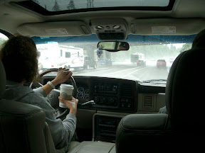
Outrunning the rain, southbound on I-5
Depressed that our premier climb for the summer was now toast, we drove to California and started climbing volcanoes. We drove to Redding in about 8 hours, with an infamous stop at the Eugene, OR, Fred Meyer store. Steve needed to unwind after battling rain and traffic-- who knew Fred Meyer could be so entertaining as we watched people's expressions as they watched Steve?
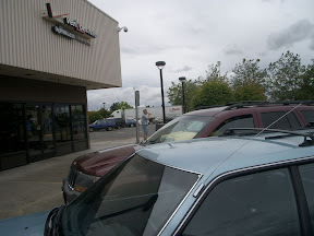
Steve, chillin' at Fred Meyer
We figured we'd need a map, and we unwisely chose a bookstore in Redding, CA, the night that the latest Harry Potter book was being released. The store was swarming with Muggles, but there were no maps in sight. Oh well, how bad could it be to get up Lassen? We didn't even know what to expect, but we thought it was a walk-up.
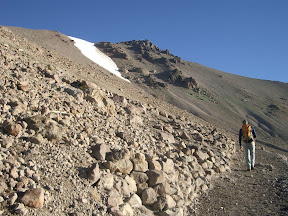
Approach to Mt. Lassen
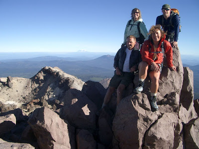
Summit of Mt. Lassen. Front: Chuck and Julie. Back: Mindy and Steve
There had been talk of just driving right to Lassen and doing a midnight climb, but it didn't sound that good after driving so long. We opted for an early-morning hike to beat the crowds. We didn't need a map to follow the switchbacks either. Just to make things interesting, we did an off-route exposed scramble near the top that we didn't need to do. The weather was mild and the wind was calm, and the sun was out. Not a cloud in the sky, and that was the point.
Next we thought we'd better get a map for Shasta. I had done some online searches and found only one route even reasonably passable-- the Hotlun-Winton route on the north side of the mountain. This avoids the crowds and infamous rockfall of the Avalanche Gulch route, which was way out of shape but still ridiculously crowded.
We weren't sure where to find the ranger station, so we checked with an incredibly unhelpful USFS office outside Redding, where the ranger was clearly pissed off that we dared to show any local knowledge of the route at all. Fortunately, we found a very helpful (and correct) ranger at the Mt. Shasta ranger station, who showed us recent photos of the route and was glad we weren't following the crowds up Avalanche Gulch.
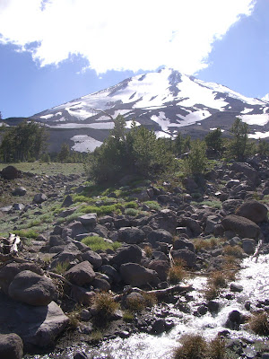
The approach was a little warm, but we were still enjoying the sun. We walked up a very circuitous trail toward a scree field, then followed various bootpaths up to a good spot on the ridge for a base camp. It took awhile, but we found a reasonably flat place somewhat sheltered from the wind and near running water.
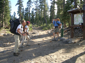
Mt. Shasta north side trailhead
We got up around 4:00 and took off at 5:00, carrying ice axes, helmets, ropes, harnesses, pickets and wearing crampons, but it turned out we didn't need the ropes or harnesses. The snow slope was pretty easy going, then we crossed over the rock ridge to the left and traversed a reasonably steep snowslope to lead to the upper glaciers/snowfields. A boulder dislodged from the rocky slopes above and tumbled down the snow-- just a reminder that the route wasn't entirely without rockfall. But it was the only rockfall we saw on that side at all.
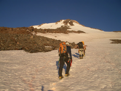
Snowslopes above base camp. Route followed right snowfield up to flat part of rocky ridge, then crossed left onto other snowfield/glacier. Steepest snow right below summit.
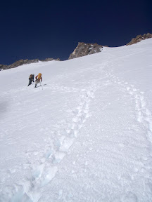
Traversing snowfield/glacier after crossing rocky ridge
We took turns kicking steps up the steepening snow, taking a steady pace above 12,000 ft. There had been recent snow on top of the ice that had bonded well, so we decided not to rope up at all. The last few pitches were maybe 50 degrees, but the steps were holding well.
We hadn't seen another person up to this point, but then we joined the south side climbers for the last traverse to the rocky summit block. There were only maybe 8 other people, but I would have preferred zero. They weren't bad-- I just didn't trust people who chose to ascend Avalanche Gulch that late in the season.
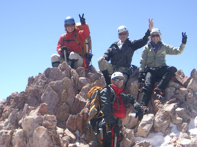
Summit of Mt. Shasta. Front: Steve. Back: Julie, Chuck, Mindy
The view was outstanding! We could see up the line of the Oregon volcanoes on a very clear day. After a few summit shots, we descended back to our base camp around 10,000 ft, took an hour to rest, eat, and hydrate, then headed back to the trailhead.
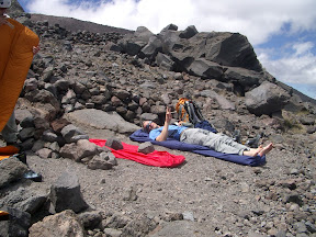
Steve chillin' (no beer) at base camp.
Mt. Shasta, from north side
At a restaurant in the funky town of Mt. Shasta, we asked our waitress the closest place we could camp and grab a shower, and she pointed us a few miles out of town. Our beers were on the house since we had summited Shasta-- sweet! We got to camp in time to shower and crash as darkness descended.
The next day we put on our tourist hats and drove through Crater Lake. What an amazing shade of turquoise! The place was an absolutely zoo full of people from all over the world. Off in the distance, across Wizard Island, we spotted our next objective.
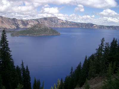
Wizard Island, Crater Lake, with Mt. Thielsen in the distance (pointed summit at right)
Mt. Thielsen has a very pointy summit. It looks like the sorting hat from Hogwart's. Unfortunately, some clouds had moved in an partially obscured the summit at times. Thunderstorms aren't unusual.
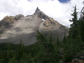
Mt. Thielsen. Route follows right skyline.
We left the trailhead for Mt. Thiesen at the crack of 2 p.m., like good peakbaggers. The trail wound up to the Pacific Crest Trail, crossed it, then continued up along the loose talus ridge. At that point, Julie's blisters wouldn't let her continue, so she headed back to the car to scope a camp site. We had a map, but the trail had been relocated from what was shown. Oh well, fortunately navigation was easy-- follow the ridge and don't fall off.
We helmeted up for a short scramble section to the base of the final summit pyramid. Chuck belayed Steve up about 20 meters of low-fifth-class rock. While Steve was setting up the anchor, the clouds rolled in again, so by the time Chuck and I got to the summit, we couldn't see a thing. Oh well. We took our cloud-enshrouded summit photo anyway, then signed the summit register. Since Thielsen is popular with thunderbolts, we rappelled off and scrambled down quickly.
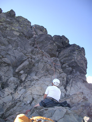
Steve leads and Chuck belays on 20-m summit pyramid
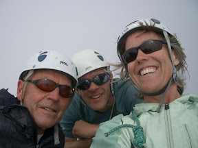
Summit of Mt. Thielsen. Chuck, Steve, and Mindy
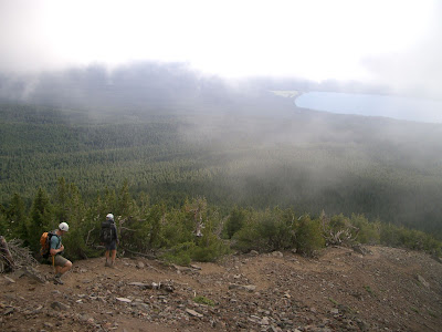
We were pretty pooped after three summits in three days. We boldly considered climbing Mt. Bachelor on the way back, but that was a little ambitious. We did scout The Sisters and McLoughlin, though, with plans to return next year.
The sunshine was a welcome break, but the gray curtain descended as we crested a pass in the Oregon Cascades. Fun road trip with great adventures!
More photos at http://picasaweb.google.com/jefacita/LassenShastaAndThielsen
No comments:
Post a Comment