Having been weathered off the same route in 2005, I conservatively planned a 3-day trip, with either a weather contingency or an option for a more casual pace. We didn't need the former, and opted for the latter, giving us plenty of time to look around, take pictures, and enjoy ourselves, especially while we had the Mazama route to ourselves.
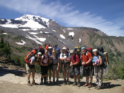
The Adams Team: Dave, Jessica, Katie, Brian, Mark, Don, Sherene (missing are Jim and Mindy)
We drove through Trout Lake and the Yakima Indian Reservation to the Bird Creek Meadows trailhead. We opted for the shorter climbers trail nearer to the ridge then wandered through the braided boot paths up to the moraine. Last time we went up and over the low point on the moraine at the high point of the vegetation, but this time we went down and around the base of the moraine-- a mistake. Don't follow this boot path, even though it looks do-able. Took us maybe an extra 30 minutes to scramble up the loose rubble to the terrace where the other route traverses to base camp. To locate best path, go up to the bootpaths to the moraine, then look for where the small trees/shrubs are highest in a triangular pattern. There is a zigzag path just above and behind that toward a saddle on the moraine.
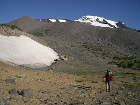
Crossing the moraine
From the top of the moraine, go uphill about 50 m then traverse across the other side of the moraine toward the flatter terrace. Pass the ice-filled lake and continue across a few meltwater streams, roughly at the same altitude. Cross a few snowfields on an ascending traverse, then climb up the short rocky section next to the stream near Sunrise Camp. On approach, we took about 3.5 hours, with lots of photo stops. On descent, we took maybe 2 hours. There were a few patches of snow closer to Sunrise Camp.
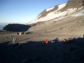
Sunrise camp
Sunrise camp was completely melted out, and I was surprised at how far up the rocks we had to walk before we hit the glacier to rope up-- much less snow than in 2005 (a very low snow year but climb was two weeks earlier) when snow was right at Sunrise Camp. Lots of running water-- very silty. Brought coffee filters to pre-filter glacial silt. Very windy/dusty camp in our Megamid! We spent a second night there instead of walking out due to tired students with blistered feet. Much better in the morning! There were several other parties in camp, but they were friendly. By the way, the Adams/forest service scat packs are not even close to gas impermeable-- I'd recommend bringing your own blue bags to avoid that fun poopy pants smell! Yeah, you know the one....
The lower glacier was in great shape! We considered going straight up on the far right, between the crevasses and rock ridge, but the hundreds of small divots in the snow suggested rockfall hazard (we didn't see or hear any while in camp, though).
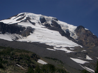
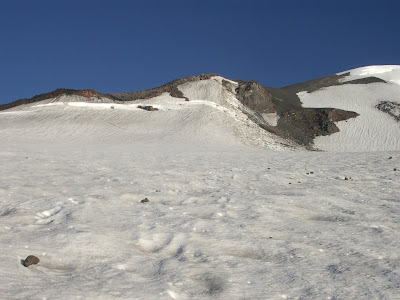
Mazama Glacier, Mt. Adams, July 2007
On the flats above the first glacier section, we traversed to the left, crossed a small bergschrund, and took the South Spur route from there. The alternative, across the glacier/snowfield to the right, crossed a rockfall area and open crevasses, and we weren't going fast enough to be safe.
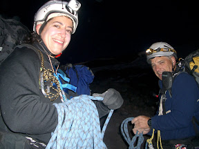
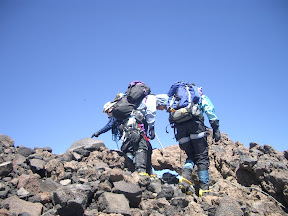
Sherene and Mark, roping up early morning
We took a rising traverse left toward the center of the glacier, keeping the smaller crevasses to climber's right, then found a great flattish ramp below the top-most crevasse that runs nearly the entire width of the glacier where we zagged back right toward the rock ridge. Because the snow was hard and ice axe arrest impossible before the next downhill crevasse, we did a running belay with three pickets driven into the very hard snow to get by that short section. Where the glacier flattens above that we considered two exits from the glacier. The "normal" route continues right up another glacier remnant, then exits leftish into the scree/talus. It looks steeper from a distance than it really is, but there was a good portion where the snow had melted out to the glacial ice underneath. However, the rock ridge that splits the right and left lobes of the glacier was melted out and lots of rocks littered the top of the glacier. With a slow pace and fully opened icy crevasses to cover, I was uncomfortable with the objective danger. Instead, we traversed left on the flattish section of glacier to where it steepened, then skirted a bergschrund on climber's left to reach the rock ridge around 10,500 ft, at a rock formation now fondly called the Scottie Dog (at least by us), crossing a short (30 ft) scree slope. We marked our ridge crossing with a wand, unroped and left our glacier gear, then took a diagonal ascent over snow and scree to meet up with the south climb around 10,800 ft or so.
There were hordes on the South Spur. The route was mostly snow covered, with a few rocky bits at the false summit and up the final climb. Pretty deep glissade chutes off the false summit. Everyone dashed their crampons and glissaded back to the point where our route went east from the south climb. Crampons balled up on the way down, but there were a few icy patches to contend with. Same running belay on descent through the crevasses on the lower glacier. We roped up at 5:00 and exited the glacier around 7:30. Climbers summited between 11:40 and 12:15 after we re-grouped at the false summit. Descent was quicker-- 3.5 hours back to camp.
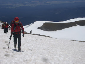
Brian nearing the summit of Mt. Adams, with Sherene and Don in the background
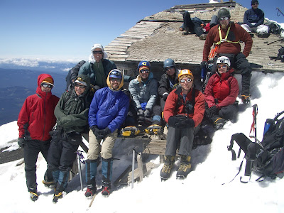
Summit of Mt. Adams. L to R: Brian, Mark, Mindy, Dave, Katie, Jessica, Jim, Sherene, Don
Jessica and Katie roping up to descend the Mazama Glacier
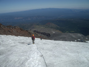
Descending Mt. Adams, Mazama Glacier
I recommend the 3-day option, especially with the combination of a long drive and opportunity for bad weather. Very fun group of people!
No comments:
Post a Comment