Wednesday, September 12, 2007

Lassen, Shasta, and Thielsen

We had planned a climb of Mt. Challenger for July 2007, several months in the making with a great team of people. Conservatively, we had an 8-day window for a 4-day climb. But we were cursed by the summer that wasn't. Summer 2007 hopefully is an anomaly. The rain just didn't quit. The latest forecast was for a storm to descend on the region and stay, eliminating any chance of climbing from British Columbia, through Washington, and south as far as Crater Lake. To get anything done, we had to go south. Way south.
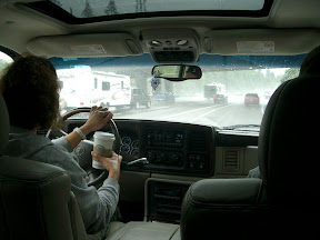
Outrunning the rain, southbound on I-5

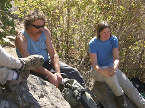
Depressed that our premier climb for the summer was now toast, we drove to California and started climbing volcanoes. We drove to Redding in about 8 hours, with an infamous stop at the Eugene, OR, Fred Meyer store. Steve needed to unwind after battling rain and traffic-- who knew Fred Meyer could be so entertaining as we watched people's expressions as they watched Steve?
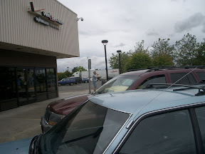

Steve, chillin' at Fred Meyer

We figured we'd need a map, and we unwisely chose a bookstore in Redding, CA, the night that the latest Harry Potter book was being released. The store was swarming with Muggles, but there were no maps in sight. Oh well, how bad could it be to get up Lassen? We didn't even know what to expect, but we thought it was a walk-up.
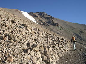

Approach to Mt. Lassen
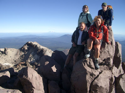

Summit of Mt. Lassen. Front: Chuck and Julie. Back: Mindy and Steve

There had been talk of just driving right to Lassen and doing a midnight climb, but it didn't sound that good after driving so long. We opted for an early-morning hike to beat the crowds. We didn't need a map to follow the switchbacks either. Just to make things interesting, we did an off-route exposed scramble near the top that we didn't need to do. The weather was mild and the wind was calm, and the sun was out. Not a cloud in the sky, and that was the point.

Next we thought we'd better get a map for Shasta. I had done some online searches and found only one route even reasonably passable-- the Hotlun-Winton route on the north side of the mountain. This avoids the crowds and infamous rockfall of the Avalanche Gulch route, which was way out of shape but still ridiculously crowded.

We weren't sure where to find the ranger station, so we checked with an incredibly unhelpful USFS office outside Redding, where the ranger was clearly pissed off that we dared to show any local knowledge of the route at all. Fortunately, we found a very helpful (and correct) ranger at the Mt. Shasta ranger station, who showed us recent photos of the route and was glad we weren't following the crowds up Avalanche Gulch.

The approach was a little warm, but we were still enjoying the sun. We walked up a very circuitous trail toward a scree field, then followed various bootpaths up to a good spot on the ridge for a base camp. It took awhile, but we found a reasonably flat place somewhat sheltered from the wind and near running water.
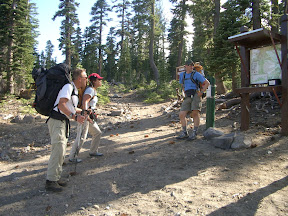


Mt. Shasta north side trailhead

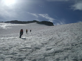
We got up around 4:00 and took off at 5:00, carrying ice axes, helmets, ropes, harnesses, pickets and wearing crampons, but it turned out we didn't need the ropes or harnesses. The snow slope was pretty easy going, then we crossed over the rock ridge to the left and traversed a reasonably steep snowslope to lead to the upper glaciers/snowfields. A boulder dislodged from the rocky slopes above and tumbled down the snow-- just a reminder that the route wasn't entirely without rockfall. But it was the only rockfall we saw on that side at all.
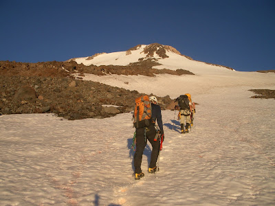
Snowslopes above base camp. Route followed right snowfield up to flat part of rocky ridge, then crossed left onto other snowfield/glacier. Steepest snow right below summit.
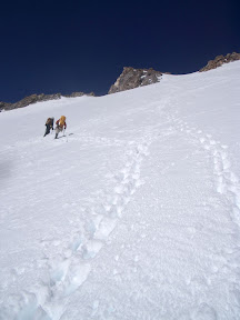

Traversing snowfield/glacier after crossing rocky ridge

We took turns kicking steps up the steepening snow, taking a steady pace above 12,000 ft. There had been recent snow on top of the ice that had bonded well, so we decided not to rope up at all. The last few pitches were maybe 50 degrees, but the steps were holding well.

We hadn't seen another person up to this point, but then we joined the south side climbers for the last traverse to the rocky summit block. There were only maybe 8 other people, but I would have preferred zero. They weren't bad-- I just didn't trust people who chose to ascend Avalanche Gulch that late in the season.
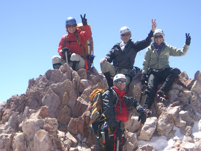
Summit of Mt. Shasta. Front: Steve. Back: Julie, Chuck, Mindy

The view was outstanding! We could see up the line of the Oregon volcanoes on a very clear day. After a few summit shots, we descended back to our base camp around 10,000 ft, took an hour to rest, eat, and hydrate, then headed back to the trailhead.
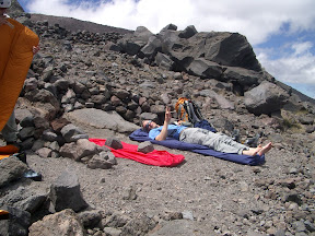
Steve chillin' (no beer) at base camp.
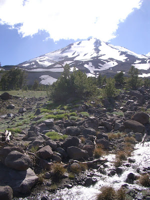
Mt. Shasta, from north side

At a restaurant in the funky town of Mt. Shasta, we asked our waitress the closest place we could camp and grab a shower, and she pointed us a few miles out of town. Our beers were on the house since we had summited Shasta-- sweet! We got to camp in time to shower and crash as darkness descended.

The next day we put on our tourist hats and drove through Crater Lake. What an amazing shade of turquoise! The place was an absolutely zoo full of people from all over the world. Off in the distance, across Wizard Island, we spotted our next objective.
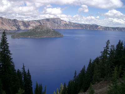
Wizard Island, Crater Lake, with Mt. Thielsen in the distance (pointed summit at right)

Mt. Thielsen has a very pointy summit. It looks like the sorting hat from Hogwart's. Unfortunately, some clouds had moved in an partially obscured the summit at times. Thunderstorms aren't unusual.
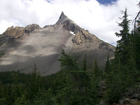
Mt. Thielsen. Route follows right skyline.

We left the trailhead for Mt. Thiesen at the crack of 2 p.m., like good peakbaggers. The trail wound up to the Pacific Crest Trail, crossed it, then continued up along the loose talus ridge. At that point, Julie's blisters wouldn't let her continue, so she headed back to the car to scope a camp site. We had a map, but the trail had been relocated from what was shown. Oh well, fortunately navigation was easy-- follow the ridge and don't fall off.

We helmeted up for a short scramble section to the base of the final summit pyramid. Chuck belayed Steve up about 20 meters of low-fifth-class rock. While Steve was setting up the anchor, the clouds rolled in again, so by the time Chuck and I got to the summit, we couldn't see a thing. Oh well. We took our cloud-enshrouded summit photo anyway, then signed the summit register. Since Thielsen is popular with thunderbolts, we rappelled off and scrambled down quickly.
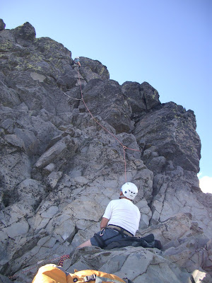

Steve leads and Chuck belays on 20-m summit pyramid
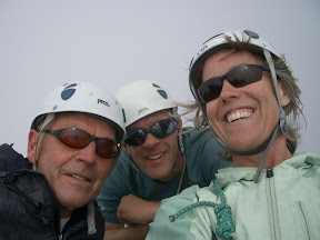
Summit of Mt. Thielsen. Chuck, Steve, and Mindy
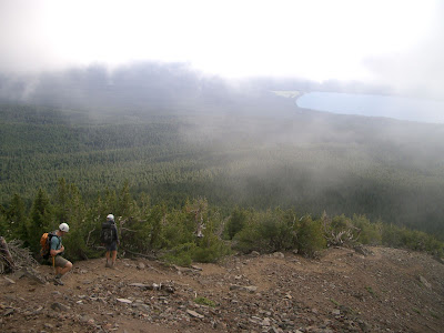

Descending loose stuff on Mt. Thielsen

We were pretty pooped after three summits in three days. We boldly considered climbing Mt. Bachelor on the way back, but that was a little ambitious. We did scout The Sisters and McLoughlin, though, with plans to return next year.

The sunshine was a welcome break, but the gray curtain descended as we crested a pass in the Oregon Cascades. Fun road trip with great adventures!

Mt. Maude, Entiat Icefall Attempt

On September 1-3, 2007, four of us (Lisa, Julie, Jim, and Mindy) attempted to climb the Entiat Icefall on Mt. Maude. A trip report from three weeks prior had raved about great conditions, 2-3 pitches of belayed climbing up to 60 degrees, and good stances for placing ice screws and building anchors. Ideal! The original plan was to climb the Lyman Glacier on Mt. Chiwawa, but poking around on the web, it looks like the Lyman Glacier has melted away to nothing, eliminating one of the best introductory alpine ice climbs in the Cascades. Julie wanted an ice climb, and the Entiat Icefall seemed like the best option to actually climb ice.

We parked at the Phelps Creek trailhead only to find at least 60 cars ahead of us. What a zoo! Fortunately, after walking 3-4 miles along the flat riverbed, we hung a right at the Leroy Creek basin climbers trail, and climbed up into the high basin to camp. There were a few tents there, but probably nowhere close to the mob scene at Spider Meadows, which would have been our approach if we stuck with climbing Chiwawa. The first 1000 ft up are pretty steep, but the grade leveled off into Leroy Basin. We were reasonably fast going to base camp (3 hours).

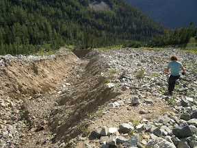
This was Lisa's first outing since her heel healed, so she and Jim hung out in base camp while Julie and I scouted the approach that we would follow in the dark the next morning. The climbers trail was a pretty good boot path until the talus fields, then we started following cairns. A woman at the trailhead had warned us about a deep gulley that was a pain to get into and out of, and that gulley became quite obvious as we got close to it. Supposedly it's been there for a few years, but it still looks fresh. We found the best booth slide down and up the other side, but it would not be fun to do in the dark.


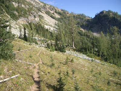
Climbers trail from Leroy Creek basin toward 6800 ft col just before talus fields. South ridge of Mt. Maude above.


Julie on recon at the 30-ft deep gulley


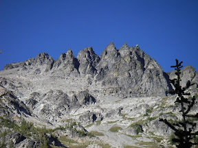
Seven-Fingered Jack from Leroy Creek Basin

Expecting a 14-hour day, we got up at 4:00 and left at 5:00 a.m., following our newly rebuilt cairns across the talus to the gulley. Yes, it was a pain. The talus continued up to the south end of Leroy basin at 6800 ft, then we continued up the shoulder to the col with the Ice Lakes basin. By this time it was light, and we could see the clouds already starting to build. Having been skunked by the weather all summer and having cowered from thunder and hailstorms in the Tetons and City of Rocks recently, I wasn't pleased. Plus, I was feeling not quite up to par thanks to some stomach bug.

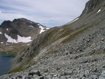
Fortunately, the 7600-ft traverse across the bench was easy to spot from the col. Unfortunately, there was very little snow left on it. Sidehilling a somewhat-steep slope covered with talus takes a lot of time and concentration. Snow is much better. But we continued to traverse above upper Ice Lake toward Marmot Pyramid. It took us longer than expected, though, thanks to the loose conditions. We reached the top of the South Entiat Glacier by about 10:00 (5 hours).


Traverse above Upper Ice Lake on 7600-ft bench under late-summer (no snow) conditions

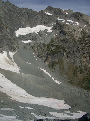
Looking at the headwaters of the Entiat River, then looking at the topographic map, it's clear that things have changed. Drastically. There are several glaciers shown in the cirque below Maude, Seven-Fingered Jack, and Fernow that simply don't exist or are very small remnants of their former selves. I guess one advantage to doing this trip so late in the season is that it's easy to distinguish snowfields from glacier. And now it's mostly snowfields that melt out each year.


Upper Entiat basin, below Maude and Fernow. Topo maps show several glaciers here, but they are long gone.


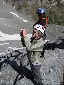
Mindy and Julie survey the scene.

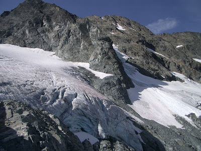
We decided to rope up and head down the South Entiat Glacier 800 ft to the base of the Entiat Icefall, as in the trip description. But we stopped at some rocks showing near the current base of the South Entiat Glacier, looking at the snout of the glacier. No wonder the original description calls for nine pitches-- it used to start way down there! At least three pitches have melted out completely. Instead of walking down the South Entiat to the base of the climb, you now have to hug the south wall of the Marmot Pyramid and look for a boulder to rappel off of to the start of the climb.


Snout of South Entiat Glacier, with Marmot Pyramid and the base of the Entiat Icefall in late-summer conditions (September 2, 2007). To reach the icefall, rap from the base of Marmot Pyramid.

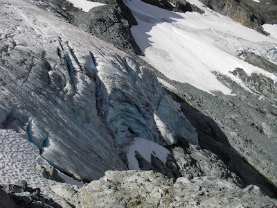
Close-up of snout of South Entiat Glacier and base of Entiat Icefall. Fresh icefall debris barely visible near upper right side of photo.

We never got a clear view of the entire icefall, but the base of it is no longer snow covered ice-- it's ice. Plus, there was new icefall debris at the base of the icefall (huh, maybe that's why they call it an ice-fall!). We had plenty of time, but with a series of yellow lights, we decided to turn around. I wasn't feeling great, Lisa wasn't sure she was up for a full 14-hour climb, the clouds were threatening, conditions had deteriorated on the icefall, and I wasn't convinced our party could move fast enough in case the weather got worse. Darn. The curse of Summer 2007.


Heading back up the South Entiat Glacier after turning around. Weather looked momentarily clear!

Maude is a very worthy objective, and I'd like to return to climb the icefall, but aiming for mid-August. Even though it was climbed over Labor Day weekend in 2000, the conditions this late in the season in 2007 just won't work (except maybe in high snow years). This was a pretty normal snow year in many areas. It's a spectacular setting, with views of Fernow, Bonanza, Seven-Fingered Jack, Glacier Peak, Buck Mountain, and Sloan and Rainier off in the distance.

The return to base camp was uneventful, and we lingered an hour at the 6800-ft col playing name that mountain. Well, Jim and Julie speculated a bunch, but then we started taking bearings to be sure. The huckleberries were ripe, and we saw lots of marmot, a few pika, a deer, and a marten-like critter. We decided to just spend the night again and hike out in the morning. I was unsuccessful in my attempt to start a game of charades, even though a had a killer first round with "sounds like Fountain Mouse." There were a few mosquitoes and black flies, but not bad at all even for a somewhat wet area. Water was still running in a few arms of the stream, even though all the snow was gone from Leroy Basin.


View of Buck Mountain (left) and Glacier Peak (right) across the Phelps Creek and Chiwawa River valleys from the south ridge of Mt. Maude.


Bears (Lisa and Jim) foraging on ripe huckleberries.

Turns out there were several other buddies of ours from the Mountaineers in the area. We ran into Steve Kleine and his wife and daughter hiking out from Spider Meadows as we were going in. John Wickham and Ron Lavigne passed us in Leroy Basin on their way in and out on a Fernow adventure. And Dan Lauren's climbing team beat us out on Monday morning on their way back from Fernow. When we got home, we found out Chuck Robinson had been on Dumbell Mountain-- all from the same trailhead. Small world.

Crack climbing at Royal Columns, Tieton

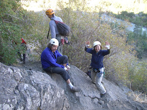
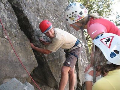
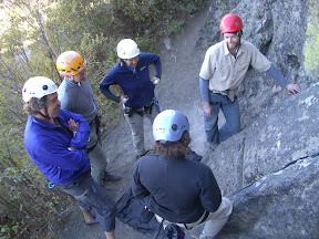
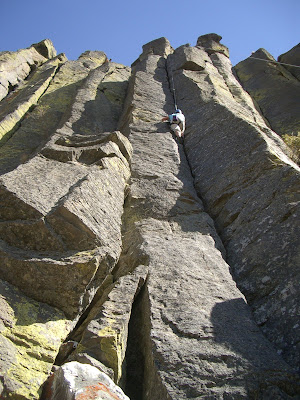
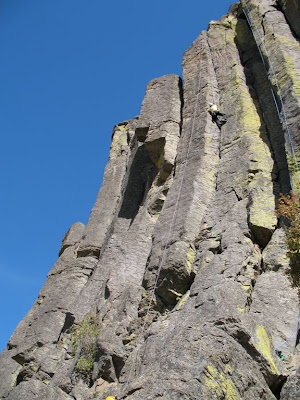
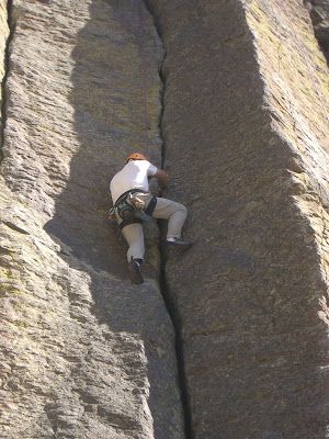
We had a great opportunity to learn the fine points of crack climbing from Jens at Max on September 8 and 9 at Royal Columns in the Tieton River area. On Saturday and Sunday, six of us each day (Jayson, Brian, Susan, Eric, Jim, and Mindy on Saturday, then Lisa, Chuck, Julie, Dale, Jim, and Mindy on Sunday) went from instructors to instructees. Among other things, we learned simple taping to protect our hands... kind of. We still had scabs afterwards.


Jens demonstrated everything from thin fingers to ring locks to cupped hands to hand jams, but let us discover useful things like arm bars on the wider cracks.


Then it was up to us to use the stuff and figure out how it works. Over the two days, we climbed a bunch of routes ranging from 5.4 to 5.10c, focusing in the 5.7 to 5.8 range.


On Saturday I was a little surprised to get near the top of Mushmaker only to get rattled at by a rattlesnake that was less than a foot from my hand on a ledge. Susan was a little puzzled when I pushed off the rock, said "Lower," then said "... faster!" It was about 4 ft long and about 1.5 inches in diameter, coiled up, and seriously ticked off at being disturbed! The next climbers didn't bother going all the way to the top of that climb. A little later, I peaked over the top of the next crack over (one of those fun, uncomfortably-wide-but-not-quite-off-width) to see if the snake had disappeared, only to find it stretched out lengthwise with its head toward the rope, slowly recoiling its head. "Lower!"

Brian didn't believe me (?!) but discovered the snake now a little bit down on the climb in a recess that was recently used for hand jams. The next day, we found the snake even further down INSIDE THE CRACK we had been using. Check where you put your hands when climbing at Royal Columns....


Julie on Mushmaker


Mindy on Inca Roads


Jim on some 5.9


Both days ended when the feet and hands gave up, sore and a little bloodied.


We're hooked!

More photos at http://picasaweb.google.com/jefacita/CrackClimbingAtTieton

Wednesday, July 11, 2007

Rainier, Emmons Route, and Jo's Ashes

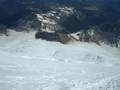
June 2007 weather was stinky. Yeah, it's usually a letdown after a brief spell of good weather in early May, but it rained for seven weekends in a row. That led to two trips cancelled for the Tahoma Route, and the Emmons Route climb was my backup. I and 15 others had been trying to scatter Jo Backus' ashes since September 2005, but schedules, poor weather, and excessive heat interfered. But I was determined that Jo would make her final climb before July 10, two years since she died in a climbing accident near Sharkfin Tower.


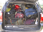
Loaded up for the three-day trip...

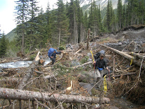
The weather forecast called for improving conditions. Good thing, since it poured the morning of our departure (June 29), then all night long while we were camped at Glacier Basin. Fortunately, it slowed to a drizzle or nothing at all during our walk into Glacier Basin, where we could see some of the havoc from last fall's storms. Hard to believe that relatively small creeks and rivers could do this kind of damage, but pretty cool from my nerd perspective.


Dave and Dorothy on the "trail" to Glacier Basin (thanks volunteers for the flagging!)


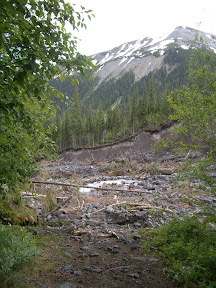
Drop off into oblivion.... Erosion from the November floods chewed up plenty of riverbanks and trail and created a steep scar on the opposite bank.

Saturday dawned sunny and warm, a welcome change. We had met up with Howard Weaver and Marlin at Glacier Basin, after their soggy attempt on Curtis Cliffs was thwarted. It was good to meet Howard in person after seeing his name for years through the Mountaineers. He knew Jo, so I let him know that we were on a special mission. We challenged Marlin to a moonwalk in his 8000-m boots (he was prepping for a trip to the Himalaya) and he made a brief attempt.


A sunny Saturday start from Glacier Basin, where the avalanche lilies were in bloom. Steve, Ben, Andrew, and David were making their first climb of Rainier.

The Interglacier was in stellar shape, with just one crevasse open up high on climber's left. The snow was just warm enough to make a solid step. We pulled on our harnesses near Camp Curtis to drop down to the Emmons and traverse over to Sherman. The drop was mostly snow covered, with very little ice showing (unlike 2006 at this time when ice made it challenging), but there were a few crevasses showing near the rocks so we swung wide.


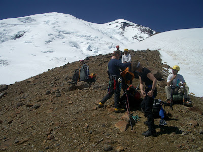
Gearing up near Camp Curtis, at the top of the Interglacier, before dropping down to the Emmons for the last climb to Camp Shurman.

Fortunately for us, there were only a handful of tents in Camp Sherman, and one low-key climbing ranger. We set up the Megamid on the snow, but David, Andrew, Ben, and Steve opted for the windier rocks for camp. Dave left his water filter stashed at Glacier Basin, so we spent the rest of the afternoon melting snow and bumming the filter from our teammates. The sun was roasting us, but it was better than rain.

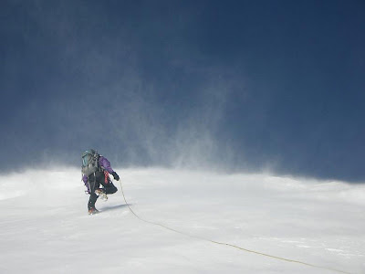
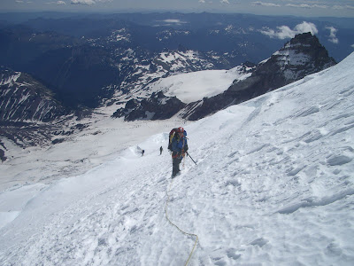
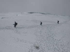
On Sunday, July 1, we got up at 12:30 a.m. and left camp around 2:10 a.m. Dave took his usual superhuman pace with Dorothy and Andrew, but I opted for the slow, steady plod with David and the last rope team with Dale, Steve, and Ben. The wind had been calm all night with a few surprising gusts that sounded like they accelerated from Glacier Basin. During our climb, these managed to pull a 180-degree turn and buffet us with a headwind of maybe 30-40 mph above about 10,500 ft. The entire way to the crest. As if slogging up a glacier and desperately seeking oxygen weren't hard enough.

Mindy somewhere on the Emmons Glacier

We could see the route from Camp Sherman pretty clearly, but it included a hard left turn around 12,500 ft and a zig so long that we couldn't see the zag to the summit. The climbing ranger told us that the route should go right at the zig, not left, and that left-going parties were having very long summit days or not summiting at all because of the extra half mile. Dave got the chance to set a new route through the crevasses and snow bridges, which was fun except that we didn't bring wands with us. With the wind, our footprints eroded before the next climber on the rope got there, so we kept looking backwards to memorize the descent route. We crossed a few snow bridges, one kind of manky one where I had David keep me on a carabiner-ice axe belay. A few climbers punched through to the kneecaps on the ascent and descent.

Jo's ashes were heavy and I wasn't feeling great, so when Dave offered to carry them at 13,500 ft I didn't even pause. Originally the plan was to share the weight among several climbers, but as Plans A through E from 2005 through June 2007 didn't work out and only Dave knew what I was up to, I had carried the ashes the whole way. That was 8 pounds in addition to my regular climbing gear and a tent I hauled into Glacier Basin when my original tent partner had to cancel.

As I pulled Jo's ashes from my pack high on Rainier's flank, my poofy down jacket jumped from my pack and started heading for Sherman. We watched it tumble downhill in the strong wind, jump a crevasse, then mysteriously come to rest around 12,000 ft. I was bummed but warm so far, so rather than worry I just mentally picked out what color my new one would be for my birthday this year.

We made Columbia Crest around 9:00 a.m., and the wind grew even stronger. As one rope team headed for the true summit, I completed my mission quietly on the side. I carefully opened the bags then held them up to the wind. This was no placid, calm scattering of ashes in a gentle breeze. Instead, Jo's ashes leaped from the bag in a stunning crescendo of action. In less than 10 seconds, her ashes had left Mt. Rainier and Washington State far behind.

When I asked Jim and Sarah Backus if they had anything they would like read or completed at the summit, they said no. Really, there just weren't any words left to send Jo on her final journey, and I just watched the ashes disperse. I've never been one to share grief with anyone, and I was relieved not to have to explain what I was doing.

The view was exceptional. Both times I had summited Rainier previously, clouds socked in the summit and I couldn't see a blasted thing. This time I could gaze down on Puget Sound over the crater of Rainier, something I had wanted to do for years. But thanks to my lost parka, I couldn't linger. In fact, I didn't even take my camera out of my pocket for a summit people or landscape picture. The views are why I climb to summits. This one is only in my head, though.

The team was pretty tired, including me, so we began the descent right away. Camp Sherman sure seems like a long way away from the top of Rainier, but we were down in about three hours. And I actually took some pictures on the descent, photos I couldn't have taken in the dark morning ascent even if I had thought about it.


Camp Sherman and the top of the Interglacier from around 12,500 ft on the Emmons Glacier.

David with Little Tahoma and the other rope team in the distance.

Dave, Dorothy, and Andrew descending through warming, squishy snow just above Camp Sherman.

David and I were around 13,000 ft when I looked down and could still see the black dot of my parka, to the left of the descent route, about 1000 ft below us. As we got closer, even with the strong wind, the parka remained anchored to the slope. And, as we got even closer, I figured it was only three rope lengths off the descent route with a reasonable, low objective hazard path toward it. After checking with David, we headed off toward my parka. I just had to find out what was holding it to the snow.

It was on a 15-degree downslope, maybe 20 ft above a crevasse. I snuck up on it, since it had jumped before, and grabbed it by the neck. What was holding it to the slope? Nothing. Nothing at all. One sleeve had a snowball in it and a small section of the neck was frozen into the snow, but there was no protrusion or anything for the jacket to catch on. Nothing. In a strong wind. Whether you believe in God, karma, or physics, something weird happened. I shook it out and stuffed it deep inside my pack. I still like the color (slate blue) so I think I'll keep it. Now I call it my karma jacket.

We retreated to Sherman, slogging through slushy snow that stuck to my aluminum crampons below 11,000 ft or so. I dashed my crampons as soon as I hit that stuff, since all I have to do is think about balling up and they do. We took a short break at camp, then packed up and headed back down the Interglacier, the site of the Best Glissade Ever. Well, one of the best. Gratifying to descend in minutes what took maybe a few hours on ascent.

The walk back was uneventful but long, especially since my big toe was repeatedly bashing into my Intuition liners. Guess FF didn't do such a great job on the fit, because I'll be losing my toenail to that trip.

I called Jim Backus as soon as we got into cell phone range, and let him know that we were finally successful. He quickly dashed off an e-mail to family and friends, letting them know that Rainier was Jo's final climb. It was a melancholy call and e-mail, and the end of a long journey. But I and the other 15 climbers involved with Plans A through F were honored to have completed this for Jim and his family, as well as for us.

I found it fitting that we released Jo's ashes on a Tacoma Mountaineers basic climb, when four basic students reached the summit as well. Jo was an exceptionally giving climber and volunteer. The climbers involved with previous attempts and plans were with us in spirit on Columbia Crest:

Marty Babare
Curt Baxstrom
Eric Black
Dave Buckland
Steve Carlin
Mark Hallman
Dale Hegg
Steve Kleine
Julie Myer
Karen Perz
Cindy Santamaria
Dennis Sherwood
Tom Shimko
Steve Townsend

Slippery Slab Tower near Stevens Pass

July 6 was stunning already, even before we headed in to climb Slippery Slab Tower. Six of us (Mindy, Jim, Cindy, Maggie, Katie, and Steve) left the Tunnel Creek trailhead (FS 6095 off the Hwy 2 hairpin turn just west of Stevens Pass) at 8:45 at a moderate pace. We reached Hope Lake and turned south on the Pacific Crest Trail at 9:45, only to hit snow above the lake that confounded routefinding. We also hit snow at the col about a half mile south, just before descending and making the traverse to Trap Pass, which it easy to lose the trail and posthole. We had a few backtracks looking for the PCT in those spots.


(Traverse on PCT after getting through snow-covered sections)

The snow was just melting out of the east-facing meadows, and the avalanche lilies were in full bloom. From Trap Pass (12:30), we looked for the climbers' trail to the east of the ridge but ended up traversing back over to the west side of the ridge at the high point between Trap Pass and Slippery Slab Tower to avoid steep snow slopes with poor runout. (We had left ice axes at home after seeing little snow below 6200 ft the week before on the Emmons Rte-- mistake!)


(Slippery Slab Tower from the PCT traverse-- mitten-shaped fin on the horizon. Trap Pass is just to the right of the photo, and we followed a climbers' trail behind the high point on the ridge, coming out on the snow just below the tower. We followed the highest snow finger right to "the obvious gulley" that reaches the first belay stance.)

The last 100 ft vertical to the base of the climb we contoured over steepening snow to the south end of the east face of the tower to find a good way up the snow finger leading to the "obvious gulley" without axes. We squeezed behind a moat/cave just south of the gulley and passed packs through-- very fun!


(Katie, Steve, Maggie, and Mindy work through the skinny moat to get to the gulley)

We arrived at the base of the climb 1:30 and began rappelling off the top at 3:00. We set a fixed line up the gulley to the trees and everyone used a prusik backup. The first few moves are a little funky, especially in boots. We were careful about some of the loose stuff, all small, and didn't rain down anything on our party. From the clump of trees, we went straight up toward the open book/slippery slab, past the last (dying?) tree right to the anchor on the ridge in one pitch. Most of us went up the arete side of the slab. Rating of 5.3 was appropriate. We unroped above the top anchor and scrambled to the summit, basking in the sun and light wind.


(East face of Slippery Slab Tower. Moat is behind the highest snow finger, and "the obvious gulley" is just to the right leading up to the belay trees on the right skyline. The route heads directly up from there in one pitch to the summit ridge.)


(Mindy belaying Maggie up to the summit ridge, with Steve's shadow looking on)


(Summit shot, front: Mindy, Steve, Maggie; back: Cindy, Katie, Jim)


(Jim doing "the Monty" on top of Slippery Slab Tower)


(Mindy and Jim setting up the short rap off the summit ridge to the (dying?) tree)

We used three single raps-- a short one from the summit anchor to the (dying?) tree, then a longer rap from the tree back to the trees at the top of the gulley, then down the gully. All three stations had good slings and rap rings, but in the coming years we might want to add bolted anchors since there is no way to back these up effectively. Rock was very solid and great for pro. I left a piece of perma-pro (curved nut) just below the open book/slippery slab if anyone wants to add to their rack.


(Mindy trying to extract perma-pro just below the open book/slipper slab, with Cindy giving a backup from the belay at the top of the gulley)

We were the first to sign the register this year-- probably another few weeks before you can (happily) go without ice axes. On the descent, we were suckered into traversing the steep snow slopes on the east side of the ridge-- not recommended without an axe, but you can avoid by going west of the ridge. Only a bit of bushwhacking required.


(Cindy, looking back on the east face of Slippery Slab Tower. The chimney toward the right/north side has given people fits over the years, so continue toward the south to the high point on the snow finger, on the left side of this photo, to pick up the gulley.)

We returned to Trap Pass for a snack, then traversed back to Hope Lake, where we were greeted by a few black flies (but not bad). Of course, we had to stop and watch the marmots and pika play in the rocks below the traverse. Got to the trailhead around 7:45 and headed to Zeke's for a milkshake.

The scenery was outstanding!

What sunscreens are effective and safe?

Have you ever wondered why your skin turns nearly purple under your SPF 50, or whether what you're applying is mutating you into a lizard? You're probably using a sunscreen that is neither effective nor safe. Since the FDA does not regulate claims on sunscreen, the Environmental Working Group compiled information on both the effectiveness and the potential health hazards of hundreds of products. Unfortunately, the one I (used to?) use, AloeGator, was not tested, so I may switch to another that is both effective and has fewer known health hazards. Check out your own brand or search for effective and safe ones at the Skin Deep Cosmetics Safety Database:

http://www.cosmeticsdatabase.com

Climbing Nerd Level 0

Tuesday, July 10, 2007

Chalk: Are we sandbagging our fingertips???

This just in (well, in 2001): the use of chalk decreases the coefficient of friction between you and those holds. What? No really, it's sort of like adding talc to a baby's bottom. OK, not exactly. But 15 climbers were the guinea pigs in a study by Li et al.:

http://www.sportex.bham.ac.uk/staff/lifx_files/Coeff%20friction%20climbing%20JSS%202001.pdf

On sandstone, slate, and granite, four hand conditions were tested: dry, dry with chalk, wet, wet with chalk. The coefficient of friction (ratio between the tangential force and the normal force) was highest for sandstone (as non-physicist climbers already knew), but the coefficient of friction was higher without chalk than with chalk for either dry or wet hands. And non-physicist climbers already knew that dry hands have a higher coefficient of friction than wet hands.

So what's going on? Looks like the chalk particles fill in those ridges that give you palm and fingerprints and act a bit like ball bearings or actually slippery flat layers.

Outcome? Find another way to dry your hands. If you use chalk to dry your hands, wipe the chalk off to maximize your Spiderman-like tendencies.

Climbing Nerd Level 0.5