Sunday, August 1, 2010

Rainier (Emmons) Women's Climb (July 7-10, 2010)


An amazing trip with remarkable women under spectacular conditions! Sally hatched the plan last winter, gathering a group of 7 women from Washington, Oregon, and New Jersey. Meanwhile, two photojournalist Friends of Mike talked about heading up Rainier as well and Mike connected the groups. We met for the first time within a week of the climb.

Janet, Mindy, Risa, Lynn, Nancy, Sally, Lisa, Bonnie, and Melina.

We walked up the White River valley trail to Glacier Basin, then followed snow up the Interglacier. The weather had literally just broken from its winterish pattern two days before, so the entire mountain was covered in fresh snow in perfect conditions. The slog up the Interglacier was hotter than ever, as the Lowlands sweltered in 80- to 90-degree heat.

Bonnie and Risa working their way up the White River valley "trail."

We had a late arrival at Camp Schurman and probably overwhelmed the hut filled with the park's ranger higher-ups. They were kind enough to give us first dibs on the stove and waited patiently for us to finish. If they had business to do, I doubt they could hear themselves over our noise.

Camp Schurman with rangers


Unfortunately, Risa came down with altitude sickness and spent the next two days in her tent. Yet somehow she had a smile on her face when she made it to an upright stance. Meanwhile, we relaxed and stayed fed and did a little basic mountaineering refresher on the slopes above Schurman-- pickets, deadman anchors, ice axe arrest, walking in crampons, glacier travel. Bonnie decided not to climb the following day, a second unfortunate event. We went to bed early even though the International Space Station was making a pass as the brightest light in the sky a little later.

The temperatures stayed pretty toasty, especially in our 3-person tents. 3:00 am came way too soon. It was such a treat to have the stove available in the Schurman hut for coffee and breakfast burritos! We finally took off just before 5:00 am as the light was bright enough to lose the headlamps. Janet tied in with Eric and River to leapfrog our two ropes. Sally led off with Nancy and Lynn followed by Lisa and I as the second rope team. I'm not sure how Janet found the energy, but after a few leaps we decided to just walk together. Sunrise high on a mountain is my favorite place and time of day, and this climb didn't disappoint.


Janet working up the Emmons route just following Sunrise.


Lisa on the Emmons route, with Camp Schurman in the background.

We kept a pretty good pace and only took one snack/potty break around 12,000 ft. The snow conditions were perfect-- hard snow for crampons. There was no sign of Mike and Melina who had left Schurman after us.
Sally, Nancy, and Lynn on the Emmons route.

Crossing the bergschrund was the easiest I had ever found it, and River said these were the best conditions he had seen on the route. What a treat! And great luck to have a late-season snowy May/June and the first sign of sunny weather just days prior. There were a few steeper steps and sastrugi right above the schrund but still phenomenal conditions. Finally the summit crater starting getting closer and closer, and we crested out a little after 10:00 am. Nice to be off the glacier for the last bits, so we dropped the rope and headed off for the true summit. Which we had entirely to ourselves-- not another soul in sight! We summited around 10:25 and spent well over an hour on the summit celebrating and savoring the view. So much happened so fast that we just couldn't aborb it all! Melina and Mike caught up to us, completing the extended group.

Mindy, Lisa, Sally, Nancy, and Lynn

Melina, Mindy, Nancy, Sally, Janet, Lynn, and Lisa, arranged to avoid clashing green jackets...

And that somehow led to a can-can dance...


A note for Risa and Bonnie

The only way to improve that moment would have been for Risa and Bonnie to join us on the summit. I sent them an M&M message (then dutifully collected the bits and pieces, which left an abstract scene best described as Clown Faceplants on Summit).

Mike in ninja black

Janet with her rope team of River (left) and Eric (right)

It was a pretty luxurious stay on the summit and it was hard to believe no one else was there on such a gorgeous day. We could see Mt. St. Helens, Mt. Baker, Glacier Peak, the Olympics, and Puget Sound-- finally! This was my 4th summit but the first time I had such a view and the time to just look around. Grudgingly we left the summit around 11:30, roped up, and headed off. Janet resumed her photojournalist role and River and Eric staked her out in the bergschrund.

Mike/Melina and Lisa/Mindy walk past Janet's roost in the bergschrund

Conditions were still amazingly good, which made for my fastest descent-- 2 hours back to Schurman! It was pretty toasty as we got to 11,000 ft and began to posthole. Coming down the Emmons, Schurman looks so small for so long that it sort of sneaks up you right before you get there. We had one small crevasse to step across and a few other very small cracks, but that was it. Sally wisely scheduled a third night at Camp Schurman. We reunited with Bonnie and Risa and spent the rest of the day relaxing, trying not to get sunburned, and chatting with people at Schurman.
Lisa, Nancy, Lynn, and Sally relaxing at Camp Schurman

A group from Colorado was in camp, and we got to talk with Vivian Underhill, the granddaughter of Miriam (and Robert) Underhill, a pioneering mountaineer of the early 1900s. Meanwhile, Bonnie made an attempt to reach the International Space Station during a few minutes when it was overhead. She made several attempts and we finally heard the ISS commander send greetings to someone else. The people around us were trying to figure out if she was really trying to call the Space Station or just crazy. No, we assured them, she's a retired astronaut. Sort of a new version of Blue Tooth Or Crazy.

Fortunately, Risa was feeling better though still not up to par the next morning, but she walked out on her own anyway. Sally and I roped up with Bonnie and Risa while Nancy, Lisa, and Lynn climbed up the Prow and met us on the Interglacier. My tentmates, Janet and Melina, had left the night before leaving way too much room in the tent, so I grabbed a bunk in Camp Schurman. When else would I have a chance to be there?
Sally, Bonnie, and Risa head down the Emmons Glacier below Camp Schurman.

Glissading the Interglacier was outstanding! How gratifying to zip down something that took hours to climb. And we stayed on the snow right down to Glacier Basin, avoiding the moraine footpath entirely. We took another break at Glacier Basin before heading down the trail. But Bonnie had another treat for us. Right before we got to the trailhead she had another window of opportunity to contact the Space Station. She reached it on the second try, and Commander Doug Wheelock sent greetings to Bonnie and the team on Mt. Rainier. How cool is that! We got a messsage from space!

Lisa and Bonnie (with Doug Wheelock by radio), reaching the International Space Station from a gravel bar in the White River valley
Tired but hungry, we headed off for pizza before heading off to our various corners. I really enjoyed meeting the other climbers and hearing their personal stories. Each has taken on remarkably complicated tasks and pulled it all off with a spirit of adventure. Thanks to all of you!

Glacier Peak Climb (July 15-18, 2010)

A tree gains a toehold on a moraine at 6700 ft (due east of pt 6787)

Scott, Ian, Chad and I set off for Glacier Peak, taking advantage of the last summer with limited access (road repairs in progress). Looking forward to about 35 miles round trip and 10,000 ft elevation gain, we left the N Fork Sauk River trailhead with our brand new Target sleeping bag (long story) but otherwise weighing in at about 40-45 lb packs. Minor bugs on the walk in, but the annoyance was nothing in comparison to the unending switchbacks (OK, 30). The view near White Pass got close to a Sound of Music moment, but the wildflower peak was still a few weeks off. We stood strong against a false charge from a marmot-- pretty pungent aroma. We decided to camp at White Pass and conscientiously excavated a snow platform for the Megamid. Far enough to the southeast on the ridge we actually had a view of Glacier Peak.

View of White Mountain (Left) and Glacier Peak (center) from SE end of White Pass.

Ian at 6500-ft saddle with Glacier Peak in the background

We got a lazy start on Day 2 and began the long traverse to the 6500-ft saddle on the ridge to the east of White Mountain. We stayed high and followed the previous boot path across steep snow slopes for the most part, but we also crossed a few heather ridges. The view from the col was incredible, and just got better. We dropped down steep snow slopes and kept traversing east and north to try to hold our elevation, but it may have been faster to drop to the basin and walk on the flats. We didn't need crampons and the snow was perfect for kicking steps. The Whitechuck Glacier on the USGS maps and in the Beckey guide is no longer, sadly. We climbed up to Glacier Gap for a sweet campsite with ready-made rock walls and a meltwater stream and a killer view. Calm winds overnight and pretty warm.

Glacier Gap camp

We rose at 3:30 am and took off a few minutes before 5 am, climbing up to the pass above camp on hard snow with crampons on and ice axes out. We traveled north up the Gerdine Ridge to about elevation 8400 ft, where we roped up to traverse northeast across the Gerdine Glacier to the saddle with the Cool Glacier. There was evidence of a recent avalanche off southeast face of Disappointment Peak, and ample rocks littering the glacier so we didn't dally at the tempting rock right in the path of the rockfall.

View across the Gerdine Glacier below Disappointment Peak
As we ascended to the saddle, I noted a few spots where people either deeply postholed or punched through snow bridges on their way down, right where the large crevasses form mid summer at the Cool/Gerdine glacier junction. The Cool Glacier really only had a single obvious crevasse with snow bridge right before the Disappointment/Glacier col, so I skirted to the south, close to Disappointment Peak, and didn't even have to step across any crevasses. Pretty remarkable snow conditions, and a testament to the late-season snow.

Disappointment Peak/Glacier Peak col

At the col we unroped but kept crampons and ice axe for the steep snow climb up the wide gully that led to the summit. A faster group of 5 on one rope hit the col at the same time and they elected to climb the gully roped but placed no pro. Seeing visions of the Mt. Hood climbing accident from a few years back, where a roped team slip clotheslined a bunch of people climbing up, we waited until the team cleared the terrain above us (15 minutes is worth the peace of mind; the leader of that team asked me about it afterwards and was very receptive to new ideas). We kicked steps and remained unroped, thanks to a skilled team comfortable with snow travel. Snow conditions were absolutely ideal for crampons. At the top of the gully, we visited both bumps just to make sure, then basked in the sun.

Near the top of the summit gully, looking down on Gerdine Ridge
The views from the top of Glacier Peak must be the best in the Cascades. The peak is surrounded by mountains, and the fighter jets the previous day were the only hint of civilization. You can't see or hear anything other than mountains, snow, and wind. It's truly spectacular, and thanks to the light wind, we spent over 45 minutes up there taking pictures of Rainier, Baker, Shuksan, Sloan, and all the other peaks you can see.

Descending the Cool Glacier

I checked everyone's comfort level descending the upper gully, and considered setting up a fixed line for a pitch. But, they were a remarkably skilled group and we elected not to rope up. The snow was just beginning to soften, which made for good plunge stepping but with crampons on for security. At the Disappointment/Glacier col we took off crampons and donned ropes for the final glacier travel. Ian led down the Cool Glacier and uneventfully passed over the top crevasse. But, where the Cool Glacier dropped into the Gerdine, both Ian and I punched through snow bridges with a leg so worked our way cautiously to the Gerdine Glacier. We traveled quickly past the rockfall, including the beckoning sun platform rock where another group not-so-wisely paused, and the avalanche debris to reach the snow on the south Gerdine ridge. We unroped and wandered back to our Glacier Gap campsite.

After two hours rest, feeding, and watering, we decided to move camp back to White Pass to make the next day more pleasant. The snow was getting a little soft, but not too bad for the traverse past the area-formerly-known-as the Whitechuck Glacier. The final climb up steep snow to the 6500-ft saddle sapped the last of our energy. In two days, the snow had really melted off the traverse back to White Pass. We passed a NOLS group out for 30 days and for some reason they didn't have ice axes out (but were wearing helmets)-- is this an odd hazing ritual? It would have been a long slide.


Back at White Pass, people were occupying our beautiful snow platform so we dug another one. Though we tried to find a place out of the wind, our Megamid nearly succumbed in the middle of the night. I awoke to a flattened Megamid wall fwapping me in the nose. You could hear the wind getting a running start in the distance, followed by fwapfwapfwapfwapfwag. A few lulls suggested it could improve ... but it didn't. Our middle people slept well but Ian and I had had enough around 6 am.

The walk out wasn't so bad, and we lingered about an hour and a half at the N Fork Sauk River right at the base of the switchbacks. A few bugs were out but little blood was lost. We hit the trailhead at 2 pm and found some lunch back in civilization before the complete reentry.

A few blisters and a little warm at times, but good people, outstanding conditions, and a great trip!

Monday, December 14, 2009

Tacoma Ice First Ascents (12/12/09)

Tacoma- City of (Ice) Destiny? We watched all week as the Arctic blast continued. Finally the day arrived when we would climb ice in our backyard. Or 5 minutes away.

I spied ice in Garfield Gulch while driving along Schuster Parkway the day before. We didn't need the usual o-dark-thirty start for this day of adventure. We walked into the gulch with ice tools, crampons, harnesses, and a rope. Jim spotted the first line, emerging from beneath the tree routes and partially obscured by ivy hanging down from the hillside. He spotted it, so the climb was his-- Dregs of the Ivy League (WI3). The ice was well bonded to the mudstone of the hillside.


I repeated the climb, but only after knocking down a free-hanging icicle. We may be free soloing these routes without ropes, but helmets are not optional. Ice climbing is dangerous business.


My line was a 15-foot wide beauty. And maybe 8 feet high. So I traversed it and named it the T-town Traverse (WI2).


At the end of the Traverse was a unique line that ended with a hooking move into the tree roots. Jim named it M&J Figure 4ever (WI2).
We exhausted the options in Garfield Gulch with some pretty efficient climbing. That and we never roped up. Unfortunately, we couldn't access the lines right above Schuster Parkway without causing accidents (cars, not us). We opted for the deepest darkest parts of Puget Gulch. Unfortunately, the groundwater was too ample and warm to freeze, so we couldn't realize our dream of climbing all three of Tacoma's gulches. Darn.

Instead, we headed out to Point Defiance, for the beautiful lines I had scouted the previous day. Unfortunately, we forgot to check the tide charts and faced high tide at Owen Beach. Our first ascents would have to wait a few hours. So we went home and had lunch. We stayed stoked though.

The tide was low enough by 3:30 pm, so we loaded up again and drove 3 minutes into Point Defiance Park. The bluffs offered limitless possibilities. Not really, but there were a few. The high tide had reached my best scouted line, and the whole thing had fallen off by the time we arrived. Or the people picking off the icicles yesterday and throwing them into Puget Sound did the trick. We would have to settle for my backup plan.

The ice was in. I geared up, opting again for the freedom that free soloing offers. My tools went in well to the plastic ice. I knocked off the first few feet of the climb but got in the swing of things and cruised to the top of the pitch, buoyed by the knowledge that no one had been here before. In winter, on ice anyway.


Jim quickly repeated the climb, and while he was on the ice, two kayakers happened by yelling "First ascent!" They were as stoked as we were, so we named the climb after them-- Defiant Kayakers (WI3). (No, not Floating Dumbasses, as the mystery kayaker suggested. Never got his name.)

There are still lines to be climbed in Tacoma. More first ascents to put up. Jim checked out a free-standing pillar, but it needs another week of Arctic blast to fill out a bit. It could be the highest unclimbed waterfall left in Tacoma.

We were totally stoked to put up so many first ascents in one day, and probably the only ice climbs within the Tacoma City limits. We were heavily influenced by previous Banff Mountain Film Festival movies by Will Gadd, free soloing, and the extreme huckleberry pickers. We're thinking of scouting Bonney Lake during the next Arctic blast. It might take another decade, or it may never happen again. But if it does, we'll be out scouting those ice lines.


Friday, May 2, 2008

The perils of daisy chains

Use with caution! If not clipped in properly, you may be connected to the world only through a few stitches: http://www.bdel.com/vids/daisy_chain_%20failure7.mov

Saturday, March 29, 2008

Article on friction knot testing

Dr. Ron Farmer, prompted by Federation Mountain Rescue (European?) tested the relative performance of four knots. In decreasing order of performance were the autoblock, Bachmann, prusik, and klemheist, tested using both 6mm and 7mm cord, for backing up a rappel.

Link to article:
http://www.rockclimbing.com/Articles/General/A_scientific_study_of_common_friction_knots._273.html
NOTE: abseil = rappel

Friday, September 28, 2007

The future of carrying heavy loads?

I haven't seen my idea for helium-filled backpack bladders take off, but here's something really different, thanks to those MIT engineers:

http://web.mit.edu/newsoffice/2007/exoskeleton-0919.html?tr=y&auid=3031538

Maybe it's an outreach program for cyborgs? Extra nerd points for you if you knew there was an International Journal for Humanoid Robotics. And, does this qualify as aid climbing? Can they make it less Gumpish?

Friday, September 21, 2007

Mt. Adams, Mazama Glacier

Tacoma Mountaineers, Basic Glacier Climb (July 27-29, 2007)

Having been weathered off the same route in 2005, I conservatively planned a 3-day trip, with either a weather contingency or an option for a more casual pace. We didn't need the former, and opted for the latter, giving us plenty of time to look around, take pictures, and enjoy ourselves, especially while we had the Mazama route to ourselves.
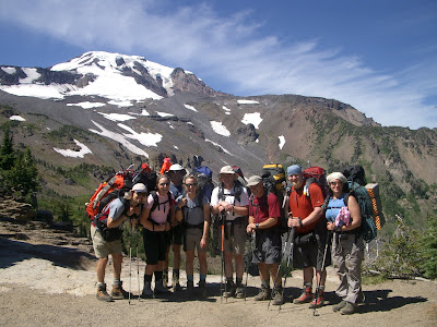


The Adams Team: Dave, Jessica, Katie, Brian, Mark, Don, Sherene (missing are Jim and Mindy)

We drove through Trout Lake and the Yakima Indian Reservation to the Bird Creek Meadows trailhead. We opted for the shorter climbers trail nearer to the ridge then wandered through the braided boot paths up to the moraine. Last time we went up and over the low point on the moraine at the high point of the vegetation, but this time we went down and around the base of the moraine-- a mistake. Don't follow this boot path, even though it looks do-able. Took us maybe an extra 30 minutes to scramble up the loose rubble to the terrace where the other route traverses to base camp. To locate best path, go up to the bootpaths to the moraine, then look for where the small trees/shrubs are highest in a triangular pattern. There is a zigzag path just above and behind that toward a saddle on the moraine.
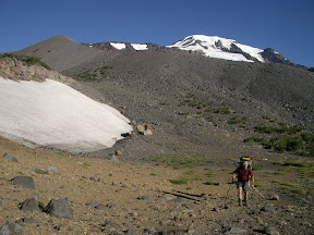

Crossing the moraine

From the top of the moraine, go uphill about 50 m then traverse across the other side of the moraine toward the flatter terrace. Pass the ice-filled lake and continue across a few meltwater streams, roughly at the same altitude. Cross a few snowfields on an ascending traverse, then climb up the short rocky section next to the stream near Sunrise Camp. On approach, we took about 3.5 hours, with lots of photo stops. On descent, we took maybe 2 hours. There were a few patches of snow closer to Sunrise Camp.
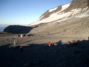


Sunrise camp

Sunrise camp was completely melted out, and I was surprised at how far up the rocks we had to walk before we hit the glacier to rope up-- much less snow than in 2005 (a very low snow year but climb was two weeks earlier) when snow was right at Sunrise Camp. Lots of running water-- very silty. Brought coffee filters to pre-filter glacial silt. Very windy/dusty camp in our Megamid! We spent a second night there instead of walking out due to tired students with blistered feet. Much better in the morning! There were several other parties in camp, but they were friendly. By the way, the Adams/forest service scat packs are not even close to gas impermeable-- I'd recommend bringing your own blue bags to avoid that fun poopy pants smell! Yeah, you know the one....

The lower glacier was in great shape! We considered going straight up on the far right, between the crevasses and rock ridge, but the hundreds of small divots in the snow suggested rockfall hazard (we didn't see or hear any while in camp, though).
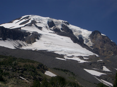


Mazama Glacier, Mt. Adams, July 2007


On the flats above the first glacier section, we traversed to the left, crossed a small bergschrund, and took the South Spur route from there. The alternative, across the glacier/snowfield to the right, crossed a rockfall area and open crevasses, and we weren't going fast enough to be safe.
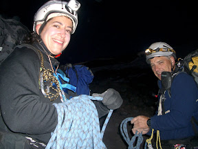


Sherene and Mark, roping up early morning

We took a rising traverse left toward the center of the glacier, keeping the smaller crevasses to climber's right, then found a great flattish ramp below the top-most crevasse that runs nearly the entire width of the glacier where we zagged back right toward the rock ridge. Because the snow was hard and ice axe arrest impossible before the next downhill crevasse, we did a running belay with three pickets driven into the very hard snow to get by that short section. Where the glacier flattens above that we considered two exits from the glacier. The "normal" route continues right up another glacier remnant, then exits leftish into the scree/talus. It looks steeper from a distance than it really is, but there was a good portion where the snow had melted out to the glacial ice underneath. However, the rock ridge that splits the right and left lobes of the glacier was melted out and lots of rocks littered the top of the glacier. With a slow pace and fully opened icy crevasses to cover, I was uncomfortable with the objective danger. Instead, we traversed left on the flattish section of glacier to where it steepened, then skirted a bergschrund on climber's left to reach the rock ridge around 10,500 ft, at a rock formation now fondly called the Scottie Dog (at least by us), crossing a short (30 ft) scree slope. We marked our ridge crossing with a wand, unroped and left our glacier gear, then took a diagonal ascent over snow and scree to meet up with the south climb around 10,800 ft or so.

There were hordes on the South Spur. The route was mostly snow covered, with a few rocky bits at the false summit and up the final climb. Pretty deep glissade chutes off the false summit. Everyone dashed their crampons and glissaded back to the point where our route went east from the south climb. Crampons balled up on the way down, but there were a few icy patches to contend with. Same running belay on descent through the crevasses on the lower glacier. We roped up at 5:00 and exited the glacier around 7:30. Climbers summited between 11:40 and 12:15 after we re-grouped at the false summit. Descent was quicker-- 3.5 hours back to camp.
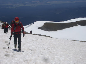

Brian nearing the summit of Mt. Adams, with Sherene and Don in the background
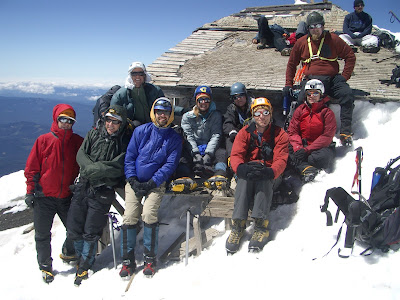

Summit of Mt. Adams. L to R: Brian, Mark, Mindy, Dave, Katie, Jessica, Jim, Sherene, Don
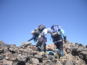

Jessica and Katie roping up to descend the Mazama Glacier
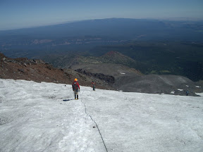

Descending Mt. Adams, Mazama Glacier

I recommend the 3-day option, especially with the combination of a long drive and opportunity for bad weather. Very fun group of people!